


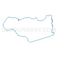
Voting District 20910, Contra Costa County, California
About
Outline

Summary
| Unique Area Identifier | 529587 |
| Name | Voting District 20910 |
| County | Contra Costa County |
| State | California |
| Area (square miles) | 0.53 |
| Land Area (square miles) | 0.12 |
| Water Area (square miles) | 0.41 |
| % of Land Area | 22.01 |
| % of Water Area | 77.99 |
| Latitude of the Internal Point | 38.02839890 |
| Longtitude of the Internal Point | -122.16859400 |
Maps


Graphs
Select a template below for downloading or customizing gragh for Voting District 20910, Contra Costa County, California


Neighbors
Neighoring Voting District (by Name) Neighboring Voting District on the Map
- Voting District 20125, Solano County, CA
- Voting District 20520, Contra Costa County, CA
- Voting District 20890, Contra Costa County, CA
- Voting District 20896, Contra Costa County, CA
- Voting District 20915, Contra Costa County, CA
- Voting District 20920, Contra Costa County, CA
- Voting District 20925, Contra Costa County, CA
- Voting District 20935, Contra Costa County, CA
- Voting District 20936, Contra Costa County, CA
Top 10 Neighboring County Subdivision (by Population) Neighboring County Subdivision on the Map
- Central Contra Costa CCD, Contra Costa County, CA (471,183)
- West Contra Costa CCD, Contra Costa County, CA (245,523)
- Vallejo CCD, Solano County, CA (144,838)
Top 10 Neighboring Place (by Population) Neighboring Place on the Map
Top 10 Neighboring Unified School District (by Population) Neighboring Unified School District on the Map
- Martinez Unified School District, CA (28,945)
- Benicia Unified School District, CA (27,136)
- John Swett Unified School District, CA (13,888)
Top 10 Neighboring State Legislative District Lower Chamber (by Population) Neighboring State Legislative District Lower Chamber on the Map
Top 10 Neighboring State Legislative District Upper Chamber (by Population) Neighboring State Legislative District Upper Chamber on the Map
Top 10 Neighboring 111th Congressional District (by Population) Neighboring 111th Congressional District on the Map
Top 10 Neighboring Census Tract (by Population) Neighboring Census Tract on the Map
- Census Tract 2520, Solano County, CA (4,157)
- Census Tract 2521.02, Solano County, CA (3,874)
- Census Tract 3180, Contra Costa County, CA (3,267)
- Census Tract 3570, Contra Costa County, CA (3,018)
- Census Tract 3160, Contra Costa County, CA (1,483)